The World Portal

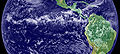
 The Blue Marble, a photograph of the planet Earth made on 7 December 1972 by the crew of the Apollo 17 spacecraft.
The world is the totality of entities, the whole of reality, or everything that exists. The nature of the world has been conceptualized differently in different fields. Some conceptions see the world as unique, while others talk of a "plurality of worlds". Some treat the world as one simple object, while others analyze the world as a complex made up of parts.
In scientific cosmology, the world or universe is commonly defined as "the totality of all space and time; all that is, has been, and will be". Theories of modality talk of possible worlds as complete and consistent ways how things could have been. Phenomenology, starting from the horizon of co-given objects present in the periphery of every experience, defines the world as the biggest horizon, or the "horizon of all horizons". In philosophy of mind, the world is contrasted with the mind as that which is represented by the mind.
Theology conceptualizes the world in relation to God, for example, as God's creation, as identical to God, or as the two being interdependent. In religions, there is a tendency to downgrade the material or sensory world in favor of a spiritual world to be sought through religious practice. A comprehensive representation of the world and our place in it, as is found in religions, is known as a worldview. Cosmogony is the field that studies the origin or creation of the world, while eschatology refers to the science or doctrine of the last things or of the end of the world.
In various contexts, the term "world" takes a more restricted meaning associated, for example, with the Earth and all life on it, with humanity as a whole, or with an international or intercontinental scope. In this sense, world history refers to the history of humanity as a whole, and world politics is the discipline of political science studying issues that transcend nations and continents. Other examples include terms such as "world religion", "world language", "world government", "world war", "world population", "world economy", or "world championship". (Full article...)
Selected articles -
-

 Map with the main travels of the Age of Discovery
The Age of Discovery (c. 1418 – c. 1620), also known as the Age of Exploration, was part of the early modern period and overlapped with the Age of Sail. It was a period from approximately the 15th to the 17th century, during which seafarers from European countries explored, colonized, and conquered regions across the globe. The Age of Discovery was a transformative period when previously isolated parts of the world became connected to form the world-system, and laid the groundwork for globalization. The extensive overseas exploration, particularly the opening of maritime routes to the East Indies and European colonization of the Americas by the Spaniards and Portuguese, later joined by the English, French, and Dutch, spurred international global trade. The interconnected global economy of the 21st century has its origins in the expansion of trade networks during this era. The exploration created colonial empires and marked an increased adoption of colonialism as a government policy in several European states. As such, it is sometimes synonymous with the first wave of European colonization. This colonization reshaped power dynamics causing geopolitical shifts in Europe and creating new centers of power beyond Europe.
Portuguese oceanic exploration began with maritime expeditions to the Macaronesian islands, including the Canary Islands, as well as Madeira and the Azores. It continued with voyages along the coast of West Africa in 1434, and culminated in the establishment of a sea route to India in 1498 by Vasco da Gama, which initiated Portugal's maritime and commercial presence in Kerala and the Indian Ocean. Spain made the transatlantic voyages of Christopher Columbus (1492–1504), which marked the beginning of colonization in the Americas, the Magellan expedition (1519–1522), which opened a route from the Atlantic to the Pacific and, under Juan Sebastián Elcano, completed the first circumnavigation of the globe. Spain also undertook other major early voyages, including the conquest of Mexico (1519–1521), the conquest of Peru (1532–1533), and the Manila galleon trade route (1565–1815), which linked the Americas and Asia across the Pacific. These Spanish expeditions significantly impacted European perceptions of the world and eventually led to numerous naval expeditions across the Atlantic, Indian, and Pacific Oceans, and land expeditions in the Americas, Asia, Africa, and Australia that continued into the 19th century, followed by polar exploration in the 20th century. (Full article...) -

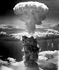
World War II, or the Second World War (1 September 1939 – 2 September 1945), was a global conflict between two coalitions: the Allies and the Axis powers. Nearly all of the world's countries participated. Tanks and aircraft played major roles, the latter enabling the strategic bombing of cities and delivery of the only nuclear weapons used in war. World War II was the deadliest conflict in history, causing the death of 60 to 75 million people. Millions died as a result of massacres, starvation, disease, and genocides, including the Holocaust. After the Allied victory, Germany, Austria, Japan, and Korea were occupied, and German and Japanese leaders were tried for war crimes.
The causes of World War II included unresolved tensions in the aftermath of World War I and the rise of fascism in Europe and militarism in Japan. Key events preceding the war included Japan's invasion of Manchuria in 1931, the Spanish Civil War, the outbreak of the Second Sino-Japanese War in 1937, and Germany's annexations of Austria and the Sudetenland. World War II is generally considered to have begun on 1 September 1939, when Nazi Germany, under Adolf Hitler, invaded Poland, after which the United Kingdom and France declared war on Germany. Poland was also invaded by the Soviet Union in mid-September and was partitioned between Germany and the Soviet Union under the Molotov–Ribbentrop Pact. In 1940, the Soviet Union annexed the Baltic states and parts of Finland and Romania, while Germany conquered Norway, Denmark, Belgium, Luxembourg, and the Netherlands. After the fall of France in June 1940, the war continued mainly between Germany, now assisted by Fascist Italy, and the British Empire and British Commonwealth, with fighting in the Balkans, Mediterranean, Middle East, East Africa, the aerial Battle of Britain, the Blitz, and the naval Battle of the Atlantic. By mid-1941, Yugoslavia and Greece had also been defeated by Axis countries. In June 1941, Germany invaded the Soviet Union, opening the Eastern Front. (Full article...) -
 Gukesh Dommaraju of India, the current world chess champion (2025)
The World Chess Championship is played to determine the world champion in chess. The current world champion is Gukesh Dommaraju, who defeated the previous champion Ding Liren in the 2024 World Chess Championship.
The first event recognised as a world championship was the 1886 match between Wilhelm Steinitz and Johannes Zukertort. Steinitz won, making him the first world champion. From 1886 to 1946, the champion set the terms, requiring any challenger to raise a sizable stake and defeat the champion in a match in order to become the new champion. Following the death of reigning world champion Alexander Alekhine in 1946, the International Chess Federation (FIDE) took over administration of the World Championship, beginning with the 1948 tournament. From 1948 to 1993, FIDE organised a set of tournaments and matches to choose a new challenger for the world championship match, which was held every three years. (Full article...) -
The Intergovernmental Panel on Climate Change (IPCC) is an intergovernmental body of the United Nations (UN). Its job is to "provide governments at all levels with scientific information that they can use to develop climate policies". The World Meteorological Organization (WMO) and the United Nations Environment Programme (UNEP) set up the IPCC in 1988. The UN endorsed the creation of the IPCC later that year. It has a secretariat in Geneva, Switzerland, hosted by the WMO. It has 195 member states who govern the IPCC. The member states elect a bureau of scientists to serve through an assessment cycle. A cycle is usually six to seven years. The bureau selects experts in their fields to prepare IPCC reports.
There is a formal nomination process by governments and observer organizations to find these experts. The IPCC has three working groups and a task force, which carry out its scientific work.
The IPCC informs governments about the state of knowledge of climate change. It does this by examining all the relevant scientific literature on the subject. This includes the natural, economic and social impacts and risks. It also covers possible response options. The IPCC does not conduct its own original research. It aims to be objective and comprehensive. Thousands of scientists and other experts volunteer to review the publications. They compile key findings into "Assessment Reports" for policymakers and the general public; Experts have described this work as the biggest peer review process in the scientific community. The IPCC was the first of three global science policy panels to be established, followed by and IPBES (Intergovernmental Platform on Biodiversity and Ecosystem Services), established in 2012 and the Intergovernmental Science-Policy Panel on Chemicals, Waste and Pollution (ISPCWP) established in 2025. (Full article...) -
 A web page from Wikipedia displayed in Google Chrome
The World Wide Web (also known as WWW, W3, or simply the Web) is a global interconnected information system that enables content sharing over the Internet. It facilitates access to documents and other web resources according to specific rules of the Hypertext Transfer Protocol (HTTP).
The Web was invented by English computer scientist Tim Berners-Lee while at CERN in 1989 and opened to the public in 1993. It was conceived as a "universal linked information system". Documents and other media content are made available to the network through web servers and can be accessed by programs such as web browsers. Servers and resources on the World Wide Web are identified and located through a character string called uniform resource locator (URL). (Full article...) -

Miss Universe is an annual international major beauty pageant that is run by the Thailand and Mexican-based Miss Universe Organization. Along with Miss World, Miss International, and Miss Earth, it is one of the Big Four beauty pageants.
The Miss Universe Organization and its brand is owned by JKN Global Group and Legacy Holding Group USA Inc., an American division of Mexican company Legacy Holding through the joint venture company JKN Legacy Inc. Telemundo had the licensing rights to air the pageant through 2023. The pageant's advocacy is "humanitarian issues and is a voice to affect positive change in the world". (Full article...) -
 Earth's atmosphere from space, showing a blue layer at the stratosphere, above the clouds of the troposphere. The Moon is visible as a crescent in the background.
The atmosphere of Earth consists of a layer of mixed gas (commonly referred to as air) that is retained by gravity, surrounding the Earth's surface. It contains variable quantities of suspended aerosols and particulates that create weather features such as clouds and hazes. The atmosphere serves as a protective buffer between the Earth's surface and outer space. It shields the surface from most meteoroids and ultraviolet solar radiation, reduces diurnal temperature variation – the temperature extremes between day and night, and keeps it warm through heat retention via the greenhouse effect. The atmosphere redistributes heat and moisture among different regions via air currents, and provides the chemical and climate conditions that allow life to exist and evolve on Earth.
By mole fraction (i.e., by quantity of molecules), dry air contains 78.08% nitrogen, 20.95% oxygen, 0.93% argon, 0.04% carbon dioxide, and small amounts of other trace gases (see Composition below for more detail). Air also contains a variable amount of water vapor, on average around 1% at sea level, and 0.4% over the entire atmosphere. (Full article...)


.jpg)


General images -
-
 Olmec colossal head, now at the Museo de Antropología de Xalapa
 -
 Artist's rendition of an oxinated fully-frozen Snowball Earth with no remaining liquid surface water. (from History of Earth)
 -
 An artist's impression of ice age Earth at glacial maximum. (from History of Earth)
 -
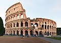 The Colosseum in Rome (from Human history)
 -
 A computer-generated image mapping the prevalence of artificial satellites and space debris around Earth in geosynchronous and low Earth orbit (from Earth)
 -
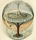 Yggdrasil, an attempt to reconstruct the Norse world tree which connects the heavens, the world, and the underworld. (from World)
 -
 Lithified stromatolites on the shores of Lake Thetis, Western Australia. Archean stromatolites are the first direct fossil traces of life on Earth. (from History of Earth)
 -
 Great Pyramids of Giza, Egypt
 -
 A map of heat flow from Earth's interior to the surface of Earth's crust, mostly along the oceanic ridges (from Earth)
 -
 COVID-19 pandemic, 2020 (from Human history)
 -
 Japanese depiction of a Portuguese carrack, a result of globalizing maritime trade
 -
-
 A composite image of artificial light emissions at night on a map of Earth (from Earth)
 -
 An artist's rendering of a protoplanetary disk (from History of Earth)
 -
 The pale orange dot, an artist's impression of the early Earth which might have appeared orange through its hazy methane rich prebiotic second atmosphere. Earth's atmosphere at this stage was somewhat comparable to today's atmosphere of Titan. (from History of Earth)
 -
 Chennakesava Temple, Belur, India
 -
 Graph showing range of estimated partial pressure of atmospheric oxygen through geologic time (from History of Earth)
 -
 Image of the physical world, captured by the Hubble Space Telescope (from World)
 -
 Cross-section through a liposome (from History of Earth)
 -
 13th-century French historiated initial with the three classes of medieval society: those who prayed (the clergy), those who fought (the knights), and those who worked (the peasantry)
 -
 Standing Buddha from Gandhara, 2nd century CE
 -
 Tiktaalik, a fish with limb-like fins and a predecessor of tetrapods. Reconstruction from fossils about 375 million years old. (from History of Earth)
 -
 Dinosaurs were the dominant terrestrial vertebrates throughout most of the Mesozoic (from History of Earth)
 -
 Earth's axial tilt causing different angles of seasonal illumination at different orbital positions around the Sun (from Earth)
 -

-
 Obelisk of Axum, Ethiopia
 -
-
 A banded iron formation from the 3.15 Ga Moodies Group, Barberton Greenstone Belt, South Africa. Red layers represent the times when oxygen was available; gray layers were formed in anoxic circumstances. (from History of Earth)
 -
 Earth depicted to scale alongside the planetary-mass objects of the Inner Solar System. From left: Mercury, Venus, Earth, the Moon, Mars and Ceres. (from Earth)
 -
 A combination of different cosmological Middle Eastern axis mundi ideas from the post-classical age (The Wonders of Creation by Zakariya al-Qazwini) showing a flat round Earth surrounded by a range of Qaf Mountains, resting on the back of a giant bull (Kujata or Behemoth), which in turn stands on a vast fish (Bahamut or Leviathan) in a cosmic ocean held up by an angel or jinn (from Earth)
 -
 A depiction of the early Solar System's protoplanetary disk from which Earth and other Solar System bodies were formed (from Earth)
 -
 A schematic view of Earth's magnetosphere with solar wind flowing from left to right (from Earth)
 -

-
 Worldwide Köppen climate classifications (from Earth)
 -
 Artist's impression of Earth during the later Archean, the largely cooled planetary crust and water-rich barren surface, marked by volcanoes and continents, features already round microbialites. The Moon, still orbiting Earth much closer than today and still dominating Earth's sky, produced strong tides. (from History of Earth)
 -
 The first airplane, the Wright Flyer, flew on 17 December 1903.
 -
 Trilobites first appeared during the Cambrian period and were among the most widespread and diverse groups of Paleozoic organisms. (from History of Earth)
 -
 Vitruvian Man, c. 1490 by Leonardo da Vinci, epitomizes the advances in art and science seen during the Renaissance. (from History of Earth)
 -
 Last Moon landing: Apollo 17 (1972)
 -
 Chloroplasts in the cells of a moss (from History of Earth)
 -

-

-
 Earth's land use for human agriculture in 2019 (from Earth)
 -
An impression of the Archean, the eon after Earth's formation, featuring round stromatolites, which are early oxygen-producing forms of life from billions of years ago. After the Late Heavy Bombardment, Earth's crust had cooled, its water-rich barren surface is marked by continents and volcanoes, with the Moon still orbiting Earth half as far as it is today, appearing 2.8 times larger and producing strong tides. (from Earth)
-
 Taj Mahal, Mughal Empire, India
 -
 A pillar at Neolithic Göbekli Tepe
 -

-
 Ming dynasty section, Great Wall of China
 -
 Portrait of Alfraganus in the Compilatio astronomica, 1493. Islamic astronomers began just before the 9th century to collect and translate Indian, Persian and Greek astronomical texts, adding their own astronomy and enabling later, particularly European astronomy to build on. Symbolic for the post-classical period, a period of an increasing trans-regional literary culture, particularly in the sciences, spreading and building on methods of science. (from Human history)
 -
Pale orange dot, an impression of Early Earth, featuring its tinted orange methane-rich early atmosphere (from Earth)
-

-

-

-
 Geologic map of North America, color-coded by age. From most recent to oldest, age is indicated by yellow, green, blue, and red. The reds and pinks indicate rock from the Archean.
 -
 Florence, birthplace of the Italian Renaissance
 -
 A reconstruction of Pannotia (550 Ma). (from History of Earth)
 -
 Artist's impression of a Hadean landscape with the relatively newly formed Moon still looming closely over Earth and both bodies sustaining strong volcanism. (from History of Earth)
 -
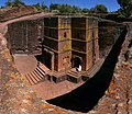 One of the eleven Rock-hewn Churches of Lalibela constructed during the Zagwe dynasty in Ethiopia (from Human history)
 -
 Pillar erected by Ashoka, a Mauryan Emperor in India
 -
-
 Battle during the 1281 Mongol invasion of Japan
 -
 Pangaea was a supercontinent that existed from about 300 to 180 Ma. The outlines of the modern continents and other landmasses are indicated on this map. (from History of Earth)
 -
 Fall of the Berlin Wall, 1989
 -

-
 A view of Earth with different layers of its atmosphere visible: the troposphere with its clouds casting shadows, a band of stratospheric blue sky at the horizon, and a line of green airglow of the lower thermosphere around an altitude of 100 km, at the edge of space (from Earth)
 -
 Artist's conception of Devonian flora (from History of Earth)
 -
 Earth's history with time-spans of the eons to scale. Ma means "million years ago", Ga means "billion years ago". (from History of Earth)
 -
 The replicator in virtually all known life is deoxyribonucleic acid. DNA is far more complex than the original replicator and its replication systems are highly elaborate. (from History of Earth)
 -
 Overall increase in average surface air temperature juxtaposed with natural drivers: human activity has caused increased temperatures, with natural forces adding some variability. (from Earth)
 -
 Successive dispersals of Homo erectus (yellow), Homo neanderthalensis (ochre) during Out of Africa I and Homo sapiens (red, Out of Africa II), with the numbers of years since they appeared before present. (from Human history)
 -
 A 580 million year old fossil of Spriggina floundensi, an animal from the Ediacaran period. Such life forms could have been ancestors to the many new forms that originated in the Cambrian Explosion. (from History of Earth)
 -
 Earth's night-side upper atmosphere appearing from the bottom as bands of afterglow illuminating the troposphere in orange with silhouettes of clouds, and the stratosphere in white and blue. Next the mesosphere (pink area) extends to the orange and faintly green line of the lowest airglow, at about one hundred kilometers at the edge of space and the lower edge of the thermosphere (invisible). Continuing with green and red bands of aurorae stretching over several hundred kilometers. (from Earth)
 -
 Notre-Dame de Paris, France
 -
 Carving of Persian and Median soldiers, Persepolis, Achaemenid Empire, 5th century BCE
 -
 A reconstruction of human history based on fossil data. (from History of Earth)
 -
 Satellite time-lapse imagery of Earth's rotation showing axis tilt (from Earth)
 -
 Machu Picchu, Inca Empire, Peru
 -
 An animation of the changing density of productive vegetation on land (low in brown; heavy in dark green) and phytoplankton at the ocean surface (low in purple; high in yellow) (from Earth)
 -
 A view of Earth with its global ocean and cloud cover, which dominate Earth's surface and hydrosphere; at Earth's polar regions, its hydrosphere forms larger areas of ice cover. (from Earth)
 -
 European migrations by mostly Germanic peoples, 2nd–6th centuries (from Human history)
 -
 Cuneiform inscription, eastern Turkey
 -
 Artist's impression of the enormous collision that probably formed the Moon (from History of Earth)
 -
 Map of Earth's 16 principal tectonic plates (from Earth)
 -
 Benin Bronze head from Nigeria
 -
 Angkor Wat temple complex, Cambodia, early 12th century
 -
-
 Artist's conception of Hadean Eon Earth, when it was much hotter and inhospitable to all forms of life. (from History of Earth)


.jpeg)


_no_borders.png)

.jpg)

.jpg)


.png)

.svg)


Megacities of the world -
.jpg)
Paris is the capital and largest city of France, with an estimated city population of 2.04 million in an area of 105.4 km2 (40.7 sq mi), and a metropolitan population of 13.2 million as of January 2026[update]. Located on the river Seine in the centre of the Île-de-France region, it is the largest metropolitan area and fourth-most populous city in the European Union (EU). Nicknamed the "City of Light", partly because of its role in the Age of Enlightenment, Paris has been one of the world's major centres of finance, diplomacy, commerce, culture, fashion, and gastronomy since the 17th century.
Administratively, Paris is divided into twenty arrondissements (districts), each having their own cultural identity. Haussmann's renovation of Paris, which created new boulevards, parks, and public works, gave birth to a modern city known as the "capital of the 19th century". Paris is a major railway, motorway, and air-transport hub; in 2024 Charles de Gaulle Airport was the EU's busiest airport. Paris has one of the most sustainable transportation systems in the world and is one of only two cities that have received the Sustainable Transport Award twice. Its Art Nouveau-decorated Métro has become a symbol of the city. Paris is known for its museums and architectural landmarks: the Musée d'Orsay, Musée Marmottan Monet, and Musée de l'Orangerie are noted for their collections of French Impressionist art, while the Musée National d'Art Moderne, Musée Rodin, and Musée Picasso are noted for their collections of modern and contemporary art. Parts of the city along the Seine have been designated as a UNESCO World Heritage Site since 1991[update]. (Full article...)
Did you know -
- ... that Shloyme Bastomski reestablished the first children's periodical published in Yiddish after it was discontinued due to World War I?
- ... that Frederick Perceval, 11th Earl of Egmont, was nicknamed "the loneliest boy in the world" by journalists?
- ... that activist Joan McIntyre left Friends of the Earth to start her own organization focused on stopping Japanese and Russian whaling?
- ... that after Spanish footballer Elene Lete had to leave Spain's under-20 football team with an injury in 2022, she returned to join the senior World Cup squad in 2023?
- ... that in the 2024 tournament, India became the first team to win the T20 World Cup without losing a game?
- ... that Michele Beevors explores the complicated relationships between humans and the natural world through hand-knitted skeletons?
- ... that, after Ustrzyki Górne was burnt down and depopulated following World War II, a students' club from Warsaw played the most important role in its reconstruction?
- ... that the Mortimer War Memorial was erected three years after the end of the First World War, but a plaque honouring those who died in the Second World War was not added until 1999?
Countries of the world -

Croatia, officially the Republic of Croatia, is a country in Central and Southeast Europe, on the coast of the Adriatic Sea. It borders Slovenia to the northwest, Hungary to the northeast, Serbia to the east, Bosnia and Herzegovina and Montenegro to the southeast, and shares a maritime border with Italy to the west. The Croatian archipelago contains over 1,000 islands and islets, the largest overseas territory on the Adriatic Sea. Its capital, largest city and main cultural and economic centre is Zagreb. Major urban centers include Split, Rijeka, and Osijek. The country is composed of twenty counties spanning 56,594 square kilometres (21,851 square miles) within four administrative regions. Croatia has a population of nearly 3.9 million as of 2026[update].
Croatian history began with the 6th century arrival of the Croats to Roman Illyria. Settled as two duchies a century later, Croatia was granted independence in 878 under Duke Branimir and elevated into a kingdom under King Tomislav in 925. The Trpimirović dynastic succession crisis placed Croatia into a personal union with Hungary in 1102. In 1527, amid Ottoman conflict, Croatia aligned with the Habsburg monarchy. It reorganized into the State of Slovenes, Croats, and Serbs before merging into the Kingdom of Yugoslavia in 1918. During World War II, most of Croatia was invaded by the Axis powers who installed a puppet state known as the Independent State of Croatia. A resistance movement restored sovereignty, emerging as the Socialist Republic of Croatia within the Socialist Federal Republic of Yugoslavia in 1943. Croatia declared independence from Yugoslavia in 1991, successfully fighting the War of Independence until 1995. (Full article...)
The Seven Wonders of Canada was a 2007 competition sponsored by CBC Television's The National and CBC Radio One's Sounds Like Canada. They sought to determine Canada's "seven wonders" by receiving nominations from viewers, and then from on-line voting of the short list. After the vote, a panel of judges, Ra McGuire, Roy MacGregor and Roberta L. Jamieson, picked the winners based on geographic and poetic criteria. Their seven picks were revealed on The National on June 7, 2007, making the official Seven Wonders of Canada, the Canoe, the Igloo, Niagara Falls, Old Quebec City, Pier 21 Halifax, Prairie Skies, and the Rockies. CBC anchor Peter Mansbridge commented on the top winner, “it’s hard to imagine Canada being Canada without the canoe. Explorers, missionaries, fur traders and First Nations—they’re all linked by this subtle and simple craft. To many, the quintessential Canadian experience begins by picking up a paddle. That’s why the canoe is one of the seven wonders” (Osler 2014). There were over 25,000 nominations and 1 million votes cast, according to the CBC website. The top audience votes were the Sleeping Giant, Niagara Falls, the Bay of Fundy, Nahanni National Park Reserve, the Northern Lights, the Rockies, and the Cabot Trail. The CBC website has a dedicated section for the Seven Wonders of Canada (https://www.cbc.ca/sevenwonders/index.html). (Full article...)
Related portals
Protected areas of the world -
-
Protected areas of Canada consist of approximately 12.1 percent of the nation's landmass and freshwater are considered conservation areas, including 11.4 percent designated as protected areas. Approximately 13.8 percent of Canada's territorial waters are conserved, including 8.9 percent designated as protected areas. Terrestrial areas conserved have increased by 65 percent in the 21st century, while marine areas conserved have increased by more than 3,800 percent.
Conservation and protected areas have different mandates depending on the organization which manages them, with some areas having a greater focus on ecological integrity, historical preservation, public usage, scientific research, or a combination of usages. Some areas such as the Polar Bear Pass, are co-managed and overseen by government and local indigenous agencies. (Full article...) -
 Large-scale protected areas of the Czech Republic: national parks (brown) and protected landscape areas (green)
There are several types of protected areas of the Czech Republic. The main form of landscape protection is delimitation of special protected areas. All the types of protected areas are determined by law. (Full article...) -
 Cranes at Sevan National Park
This is a list of protected areas in Armenia that are categorized as follows: 4 national parks, 3 state reserves, 27 state sanctuaries and 5 botanical gardens. The percentage of protected land in Armenia is approximately 12.89% (2309.0853 km² 891.542819 sq mi). (Full article...) -
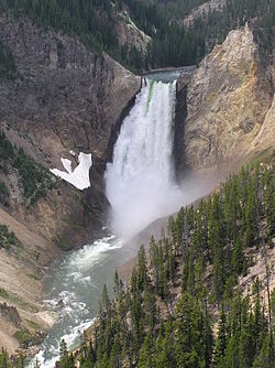 Grand Canyon of Yellowstone
The protected areas of the United States are managed by an array of different federal, state, tribal and local level authorities and receive widely varying levels of protection. Some areas are managed as wilderness, while others are operated with acceptable commercial exploitation. As of 2022[update], the 42,826 protected areas covered 1,235,486 km2 (477,024 sq mi), or 13 percent of the land area of the United States. This is also one-tenth of the protected land area of the world. The U.S. also had a total of 871 National Marine Protected Areas, covering an additional 1,240,000 mi2 (3,200,000 km2), or 26 percent of the total marine area of the United States. (Full article...) -
The Ulyanovsk Oblast in Russia contains about 118 protected natural areas. (Full article...)
-
 Ludaš Lake is a shallow lake in the province of Vojvodina in northern Serbia, near the city of Subotica. It is a special natural preserve and, since 1977, designated as a swamp area of international significance by the Ramsar Convention.
Protected areas cover around 5% of the territory of Serbia. The Law on the Protection of the Nature defines these categories of protected areas:- Strict nature reserve — Area of unmodified natural features with representative ecosystems set aside for the preservation of its biodiversity and for scientific research and monitoring.
- Special nature reserve — Area of unmodified or slightly modified natural features of great importance due to uniqueness and rarity which includes the habitats of endangered species set aside for the preservation of its unique features, education, limited tourism and for scientific research and monitoring.
- National park — Area with large number of diverse ecosystems of national value, with outstanding natural features and/or cultural heritage set aside for the preservation of its natural resources and for educational, scientific and tourist use.
- Natural monument — Small unmodified or slightly modified natural feature, object or phenomenon, easily detectable and unique, with unique natural attributes.
- Protected habitat — Area which includes habitats of one or more wildlife species.
- Landscape of outstanding features — Area of remarkable appearance with important natural and cultural value.
- Nature park — Area of well-preserved natural values with preserved natural ecosystems and picturesque landscape set aside for the preservation of biodiversity and for educational, tourist, recreational and scientific use.
-
 The sun over the Lake Niassa Reserve
Protected areas in Mozambique are known as conservation areas, and are currently grouped into national parks, national reserves, forest reserves, wildlife utilisation areas (coutadas), community conservation areas, and private game farms (fazendas de bravio). There are also a number of areas that have been declared as protected areas under a variety of different legislation, which for reasons of simplicity are here grouped together as "other protected areas." Under the Conservation Law of 2014 (Law 16/2014 of June 20), protected areas will need to be reclassified into a much more flexible series of new categories which are closer to the international system used by the IUCN. International initiatives such as transfrontier parks are grouped at the end of the page. (Full article...) -
-
The state of Johor in Malaysia is noted for its national parks and forest reserves which preserve virgin rainforests known for its biodiversity and endangered species of animals.
Mangrove swamps and coral reefs are also protected within these parks. (Full article...) -
 Mombacho Volcano Natural Reserve
The protected areas of Nicaragua are areas that have natural beauty or significance and are protected by Nicaragua. Nicaragua has 78 protected areas that cover 22,422 km2, about 17.3% of the nations landmass. The National System of Protected Areas (SINAP) is administered by the Ministry of the Environment and Natural Resources (MARENA). (Full article...) -
Greece is characterized by an extremely fragmented, rugged landscape hosting a great diversity of ecosystems and an outstanding biodiversity. Almost 5% of its extensive coastline consists of ecologically sensitive wetlands. Two thirds of the total population live no further than 2 km from the coast and most of the important urban centers are coastal, while almost all of the tourist infrastructure is divided among islands and the coastal mainland. (Full article...)
-
 Cape Spencer Lighthouse, Innes National Park
Protected areas of South Australia, consisting of protected areas located within South Australia and its immediate onshore waters and which are managed by South Australian Government agencies. As of 2018, South Australia contained 359 separate protected areas declared under the National Parks and Wildlife Act 1972, the Crown Land Management Act 2009 and the Wilderness Protection Act 1992. Together, they cover a total land area of 211,387.48 km2 (81,617.16 sq mi) or 21.5% of the state's area. (Full article...) -
 A Bengal Tiger in Bardiya National Park
The protected areas of Nepal cover mainly forested land and are located at various altitudes in the Terai, in the foothills of the Himalayas and in the mountains, thus encompassing a multitude of landscapes and preserving a vast biodiversity in the Palearctic and Indomalayan realms.
Nepal covers 147,181 km2 (56,827 sq mi) in the central part of the Himalayas. Altitudes range from 67 m (220 ft) in the south-eastern Terai to 8,848 m (29,029 ft) at Mount Everest within a short horizontal span. This extreme altitudinal gradient has resulted in 11 bio-climatic zones ranging from lower tropical below 500 m (1,600 ft) to nival above 5,000 m (16,000 ft) in the High Himalayas, encompassing nine terrestrial ecoregions with 36 vegetation types.
Additionally, nine Ramsar sites were declared between 1988 and 2008. Two wildlife reserves were declared as national parks in 2017. (Full article...) -
-
Protected areas of Tasmania consist of protected areas located within Tasmania and its immediate onshore waters, including Macquarie Island. It includes areas of crown land (withheld land) managed by Tasmanian Government agencies as well as private reserves. As of 2016, 52% of Tasmania's land area has some form of reservation classification, the majority is managed by the Tasmania Parks and Wildlife Service (about 42% of total Tasmanian land area). Marine protected areas cover about 7.9% of state waters.
Within each classification of reserve there may be a variation of IUCN categories Australia is a signatory to the Convention of Biological Diversity and as such has obligations to report the status of its National Reserve System.IUCN provides on its website a prescription for activities consistent with the categorisation system. Changes made to the Nature Conservation Act 2002 in 2014 permit timber harvesting. These changes made in addition to the already established right to access minerals means that many of the IUCN categorisations assigned to individual reserves in Tasmania are no longer fit for purpose. In addition many reserves have had their reserve status downgraded from a class excluding timber harvesting and mineral extraction to ones where these activities are now permitted. This mis-application of the IUCN protected area categories needs to be remedied or the reserves protected land class under the Nature Conservation Act 2002 should be adjusted to reflect its currently assigned IUCN category. (Full article...)
.svg)


.jpg)


Selected world maps
-
 The world map by Gerardus Mercator (1569), the first map in the well-known Mercator projection
 -
 1516 map of the world by Martin Waldseemüller
 -
 Index map from the International Map of the World (1:1,000,000 scale)
 -
 Only a few of the largest large igneous provinces appear (coloured dark purple) on this geological map, which depicts crustal geologic provinces as seen in seismic refraction data
 -
 A plate tectonics map with volcano locations indicated with red circles
 -
 The Goode homolosine projection is a pseudocylindrical, equal-area, composite map projection used for world maps.
 -
 Mollweide projection of the world
 -
 Time zones of the world
 -
 United Nations Human Development Index map by country (2016)


World records
- List of Olympic records in athletics
- List of world records in athletics
- List of junior world records in athletics
- List of world records in masters athletics
- List of world youth bests in athletics
- List of IPC world records in athletics
- List of world records in canoeing
- List of world records in chess
- List of cycling records
- List of world records in track cycling
- List of world records in finswimming
- List of world records in juggling
- List of world records in rowing
- List of world records in speed skating
- List of world records in swimming
- List of IPC world records in swimming
- List of world records in Olympic weightlifting
Topics

Continents of Earth | ||||||||
|---|---|---|---|---|---|---|---|---|
| ||||||||
| ||||||||
| ||||||||


| Cenozoic Era (present–66.0 Ma) |
| ||||||||||||
|---|---|---|---|---|---|---|---|---|---|---|---|---|---|
| Mesozoic Era (66.0–252 Ma) |
| ||||||||||||
| Paleozoic Era (252–539 Ma) |
| ||||||||||||
| Proterozoic Eon (539 Ma–2.5 Ga) |
| ||||||||||||
| Archean Eon (2.5–4 Ga) | |||||||||||||
| Hadean Eon (4–4.6 Ga) | |||||||||||||
ka = kiloannum (thousand years ago); Ma = megaannum (million years ago); Ga = gigaannum (billion years ago). See also: Geologic time scale • | |||||||||||||
| Locations | ||
|---|---|---|
| Related | ||

| |||||||||||||||||||
| |||||||||||||||||||
| |||||||||||||||||||
Economic classification of countries | |||||
|---|---|---|---|---|---|
| Three-World Model | |||||
| Gross domestic product (GDP) |
| ||||
| Gross national income (GNI) | |||||
| Wages | |||||
| Wealth | |||||
| Other national accounts | |||||
| Human development | |||||
| Digital divide | |||||
| Net international investment position (NIIP) | |||||
| Technological |
| ||||
|---|---|---|---|---|---|
| Sociological | |||||
| Ecological |
| ||||
| Biological |
| ||||
| Astronomical | |||||
| Eschatological |
| ||||
| Others |
| ||||
| Fictional | |||||
| Organizations | |||||
Categories
Wikimedia
The following Wikimedia Foundation sister projects provide more on this subject:
-
 Commons
Free media repository -
 Wikidata
Free knowledge base -
 Wikiquote
Collection of quotations -
 Wikisource
Free-content library -
 Wikispecies
Directory of species -
 Wikiversity
Free learning tools -
 Wikivoyage
Free travel guide -
 Wiktionary
Dictionary and thesaurus